


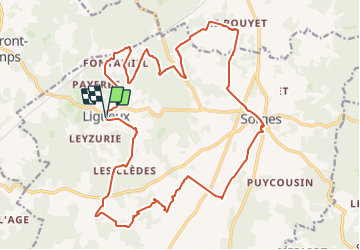

10.5 km | 13.4 km-effort


User


FREE GPS app for hiking
 SityTrail
IGN / Geographical institutes
SityTrail World
The world is yours!
Trail Walking of 25 km to be discovered at New Aquitaine, Dordogne, Sorges et Ligueux en Périgord. This trail is proposed by audier.
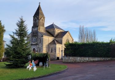
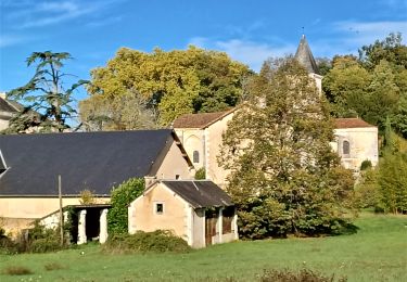
Par de chemins balisés , du GR de Saint Jacques De Compostelle et de petites routes, vous découvrirez un patrimoine(demeures,chateaux,manoirs). Le village de Sorges capital du diamant noir la truffe.
Un musée est dédié à ce tubercule.


sport

Walking
Walking
Walking
Walking

Walking

Walking
Walking
Walking